
SPECIAL WEATHER STATEMENT
Issued by The Bahamas Department of Meteorology at 9:00 PM Monday, 6th June, 2022
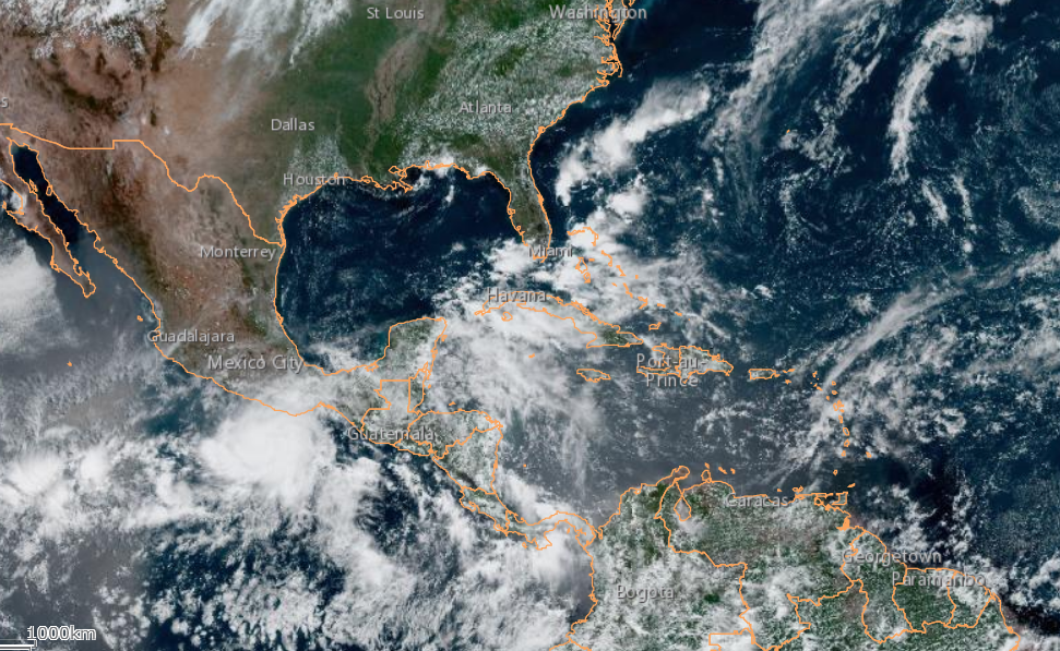
Inclement and wet weather is expected for the Northwest and Central Bahamas into Tuesday, 7th June, 2022.
A long trailing plume of moisture/rainband associated with Post-Tropical Storm Alex that extends westwards across the Northwest and Central Bahamas will interact with a mid to upper-level trough moving eastwards across Central/North Florida tonight (Monday) through Tuesday to produce shower and thunderstorm activity across the area. This moisture plume is expected to slowly lift northwards across the area through midweek.
Environmental conditions will become conducive for the enhancement of showery activity and thunderstorms that is likely to produce occasionally heavy rainfall. As the ground is saturated at this time due to earlier rainfall events, this will lead to flooding in low-lying and flood-prone areas as well as ponding on roads in some of the islands.
Residents in the Northwest and Central Bahamas particularly Grand Bahama, Abaco, Bimini, The Berry Islands, Andros, New Providence, Eleuthera, Exuma and its Cays, and Cat Island, should remain vigilant and ready to take the necessary action to protect property and person during the heavy rainfall event.
The Bahamas Department of Meteorology will continue to update the public of any significant changes to this event.
Mr. Gregory D Thompson CCO
Bahamas Department of Meteorology
Nassau, Bahamas
———–
SPECIAL WEATHER STATEMENT
Issued by The Bahamas Department of Meteorology at 12 NOON Thursday 02nd June, 2022
A Broad area of disturbed weather in the Northwest Caribbean Sea may develop into a Tropical Depression or Storm over the next few days
A low pressure center embedded in an extensive area of disturbed weather located just east of the Yucatan Peninsula continues moving slowly northwestward over the northwestern portion of the Caribbean Sea. Satellite imagery shows disorganized clusters of scattered to numerous moderate showers with isolated strong thunderstorms. There is a high chance that this system may intensify and become a Tropical Depression or Storm over the next few days as it approaches the Florida Peninsula and the Northwest Bahamas. Should this occur, a Tropical Storm Watch will be issued for the Northwest Bahamas.
In any event, residents in the Northwest Bahamas particularly Bimini, Grand Bahama, Abaco, Berry Islands and North Andros should prepare for severe and intense shower and thunderstorm activity with excessive rainfall beginning Friday night the 3rd June, 2022 and into Saturday 4th June, 2022. Prolonged rainfall resulting in localized flooding in low-lying areas is anticipated. They should also continue to monitor all weather statements issued by the Bahamas Department of Meteorology.
The Bahamas Department of Meteorology will continue to monitor this system and update the public of any significant development. The public should note that the 1st of June began the 2022 Atlantic Hurricane Season and is therefore advised to continue preparations.
Mr. Jeffrey Simmons
Actg. Director
Bahamas Department of Meteorology
Nassau, Bahamas
————
SPECIAL WEATHER STATEMENT
Issued by The Bahamas Department of Meteorology at 12 NOON Wednesday 01st June, 2022
Intense inclement and wet weather ahead for the Northwest and Central Bahamas for the weekend
An extensive area of disturbed weather located near the Yucatan Peninsula is interacting with an upper-level trough over the Gulf of Mexico to produce a broad region of intense shower and thunderstorm activity. This system is moving in a northeastward direction and will move near the Northwest Bahamas during the night of Friday 3rdJune, 2022. It will traverse the Florida Peninsula and exit the area by Monday 6th June, 2022.
Environmental conditions are conducive for gradual development. This system may develop into a Tropical Depression by the weekend. Hence, a Tropical Storm Watch may be issued for the Northwest Bahamas during this time.
Residents in the Northwest and Central Bahamas should prepare for severe and intense shower and thunderstorm activity with excessive rainfall. Prolonged rainfall resulting in localized flooding in low-lying areas is anticipated. The islands of Bimini, Grand Bahama, Berry Islands and Abaco will experience the brunt of this disturbed weather on Saturday 4th June, 2022.
The Bahamas Department of Meteorology will continue to monitor this system and update the public of any significant development.
The public should note that today, Wednesday, 1st June 2022, commences the Atlantic Hurricane Season and is therefore advised to continue preparations.
Mr. Jeffrey Simmons
Actg. Director
Bahamas Department of Meteorology
Nassau, Bahamas
—————————–
Original Article:
SPECIAL WEATHER STATEMENT
Issued by The Bahamas Department of Meteorology at 12 NOON Monday 30th May, 2022
Inclement and very wet weather ahead for the week for The Bahamas
A broad low pressure trough straddling the Northwest and Central Bahamas will linger over the area for the next few days. This trough will eventually lift and move northeastward into the open Atlantic Ocean by Thursday. Periods of scattered showers and isolated strong to severe thunderstorms are expected during the week. Heavy downpours, strong gusty winds and frequent lightning activity will accompany severe thunderstorm activity. Prolonged rainfall resulting in localized flooding in low-lying areas is anticipated. Some improvement in weather conditions is forecast for the extreme Northwest (Bimini, Berry Islands, Grand Bahama, Abaco) and Northwest Bahamas (North Andros, New Providence, Eleuthera) on Wednesday 1st June and Thursday 2nd June respectively.
The Bahamas Department of Meteorology is also closely monitoring the possibility of a broad area of showers and thunderstorm, associated with the remnants of Hurricane Agatha presently located of the southeast coast of Mexico. Development of this disturbance is expected near the Yucatan Peninsula and the southwest Gulf of Mexico by Wednesday. Weather Forecast models are indicating that this disturbance could develop into a low pressure system and begin moving toward the northeast Thursday night. This low pressure system is further forecast to deepen and move across Central Cuba on Friday and into the Northwest Bahamas early Saturday morning.
There is a possibility that this could develop into a tropical depression or storm as it approaches The Bahamas. The Bahamas Department of Meteorology will continue to monitor and update the public on any possible development. In any event, residents in the Northwest and Central Bahamas should prepare for intense thunderstorm activity with excessive rainfall beginning the night of Friday 3rd June continuing into Sunday 5th June.
The public should note that the 1st June begins the 2022 Atlantic Hurricane Season and is therefore advised to continue preparations.
PLEASE BY ADVISED THAT THIS STATEMENT WILL BE UPDATED ON WEDNESDAY 1ST JUNE 2022.
Mr. Jeffrey Simmons
Actg. Director
Bahamas Department of Meteorology Nassau, Bahamas
