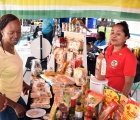
NASSAU… (June 17th 2014).. The Bahamas Petroleum Company plc (BPC) announced today that it has completed environmental sensitivity maps of coastal area habitats, fauna and flora and sensitive receptors to allow the Company, any stakeholders or agencies to have a better understanding and appreciation of coastal life and usage.
“The Company recognized there was a need to create a series of environmental sensitivity maps (ESM) for a large area across the islands of The Bahamas,” said Ms. Roberta Quant, BPC Environmental Scientist. “In the case of any tangible or credible threat to the environment, these maps could guide and inform anyone, including ourselves, to those sensitive areas that require immediate attention; in other words, it allows any responders to prioritize and maximize protection efforts in specified areas. Our extensive mapping encompassed the oceans and coastlines for critical habitats, usage, natural communities and wildlife occurrences which allowed the identification of sensitive receptors that exist in the area. With this information we then created a further set of maps that we call environmental sensitivity index maps which further classifies in greater detail individual coastlines and combines information on species distribution, ecosystem ecology, oceanography and Mr. Simon Potter BPC CEO added. “Fortunately, BPC’s exploration locations are some distance from identified, mapped sensitive habitats. But importantly, in order to initiate any effective response no matter where the perceived threat originates, it is imperative to know precisely how to access areas requiring the most urgent attention. This, to mobilise equipment and resources to help the authorities in any threatening situation, to affect an appropriate and immediate response in order to ensure those areas that demand it are adequately, appropriately and correctly protected.”
The maps were created with the help of local islanders, scientific experts, local fishermen, government agencies, local environmental non-governmental organizations, local research organizations and even real estate agencies. Collated, the information included their view of priorities in highlighting critical and natural wildlife communities, their activities and habitats that may have the potential to be impacted if any natural or uncommon threat emerged. For instance, they show us such things as the turtle nesting beaches, blue holes, important birding areas, coral reefs, sea grass beds and wetlands.
Mr. Potter explained that anywhere in the world where a threat to the environment may become apparent, the need to know, in advance, the most exposed areas, the most sensitive or the most sensitized to any particular threat, is crucial in ensuring scarce resources are mobilized for The Sensitivity Maps, and the Indexes that go with them, Ms. Quant went on to say, were “Communities and agencies voluntarily assisted in the creation of the maps, though at least initially, with very little to go on. But with a series of site visits, local dialogues, inspections and surveys across the Family Islands involving really anyone or any group with a view or pertinent information, knowledge or interest over these huge, huge areas of The Bahamas, things gradually came together. The creation of the Environmental Sensitivity and Index Maps took nearly a year to complete and will serve as a foundation for any management plans for the safeguarding of the environment for present and future generations.”
For further information BPC’s Annual Reports and all other company information can be found at www.bpcplc.com and at http://www.best.bs/index.html for the BEST Commission which has the complete list of all the regulatory required measures put in place and met by BPC including the Environmental Impact Assessment.


