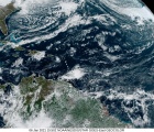

General Situation: Troughing in the atmosphere over the area will enhance convective activity across the Bahamas with some showers and thunderstorms likely to become heavy to severe at times. Surface high pressure ridge will sustain gentle to fresh breezes to make the hot temperature and the triple digit heat indices a little more bearable. A mix of sun and clouds will dominate weather conditions this week as multilayered troughing keeps the atmosphere unstable.
- Monday 19th – Variably cloudy, breezy, and hot with few scattered showers and thunderstorms, some becoming heavy to severe at times during the daytime through nightfall. Maximum temperature 91°F and a minimum temperature 79°F. Small craft should exercise caution in the Central and SE Bahamas. Winds E’ly at 10 to 15 knots in the NW Bahamas, but gusty at times and E to SE at 15 to 20 knots in the Central and SE Bahamas. Seas 2 to 4 feet in the NW Bahamas, but higher in gusts and 4 to 6 feet in the Central and SE Bahamas.
- Tuesday 20th – Variably cloudy, breezy and hot with some scattered showers and thunderstorms, some becoming heavy to severe at times during the daytime through nightfall. Maximum temperature 92°F and a minimum temperature 79°F. Small craft should exercise caution in the Central and SE Bahamas. Winds E to SE at 10 to 15 knots in the NW Bahamas with stronger gusts at times and E to SE at 15 to 20 knots in the Central and SE Bahamas. Seas 2 to 4 feet over the NW Bahamas, building up to 6 feet at times in gusts and 4 to 6 feet in the Central and SE Bahamas.
- Wednesday 21st – Partly sunny, hot and humid with few scattered showers and isolated thunderstorms mainly across the NW and SE Bahamas during the daytime. Partly cloudy and warm with lingering scattered showers or a possible isolated thunderstorm in the SE Bahamas through nightfall. Maximum temperature 91°F and minimum temperature 79°F. Small craft should exercise caution in parts of the Central and SE Bahamas early. Winds E to SE at 10 to 15 knots in the NW Bahamas and E’ly at 15 to 20 knots in the Central and SE Bahamas. Seas 2 to 4 feet in the NW Bahamas and 4 to 6 feet in the Central and SE Bahamas.
- Thursday 22nd – Partly to mostly cloudy, humid and hot with few passing showers or the chance of an isolated thunderstorm during the daytime through nightfall. Maximum temperature 90°F and minimum temperature 79°F. Small craft should continue to exercise caution across the SE Bahamas early. Winds E to SE at 10 to 15 knots in the NW and Central Bahamas, decreasing to 10 knots or less at times and E’ly at 15 to 20 knots early in the SE Bahamas, decreasing to 10 to 15 knots later. Seas 2 to 4 feet in the NW and Central Bahamas, falling to 1 to 3 feet at times and 4 to 6 feet in the SE Bahamas, falling to 2 to 4 feet later.
- Friday 23rd – Partly to mostly cloudy, humid and hot with few scattered showers and isolated thunderstorms across the Bahamas during the daytime through nightfall. Maximum temperature 90°F and a minimum temperature 79°F. Small craft should exercise caution across the SE Bahamas. Winds E to SE at 10 to 15 knots in the NW and Central Bahamas, falling to 10 knots or less over parts of the NW Bahamas and E to SE at 15 to 20 knots in the SE Bahamas. Seas 2 to 4 feet in the NW and Central Bahamas and 4 to 6 feet in the SE Bahamas.
- Saturday 24th – Variably cloudy, hot and humid with few passing showers and isolated thunderstorms during the daytime through nightfall. Maximum temperature 90°F and a minimum temperature 79°F. Small craft should exercise caution in the Central and SE Bahamas but the caution will cease by afternoon in the Central Bahamas. Winds SE’ly at 10 to 15 knots in the NW Bahamas and E to SE at 15 to 20 knots in the Central and SE Bahamas, decreasing to 10 to 15 knots in the Central Bahamas later. Seas 2 to 4 feet in the NW Bahamas and 4 to 6 feet in the Central and SE Bahamas, falling to 2 to 4 feet in the Central Bahamas later.
- Sunday 25th – Variably cloudy, humid and hot with few scattered showers and isolated thunderstorms across the Bahamas during the daytime through nightfall. Maximum temperature 91°F and a minimum temperature 79°F. Small craft should continue to exercise caution across the SE Bahamas. Winds SE’ly at 10 to 15 knots in the NW and Central Bahamas but gusty at times and E to SE at 15 to 20 knots across the SE Bahamas. Seas 2 to 4 feet across the NW and Central Bahamas but higher in gusts and 4 to 6 feet in the SE Bahamas.
Beachgoers and mariners should be vigilant for rough surf and the moderate to high risk of dangerous rip currents mainly along the east coast beaches during the stated advisories. Mariners should exercise caution for gusty winds and higher seas during heavy showers or thunderstorms. Mariners should also be alert for waterspout activity during the daytime through nightfall across all areas. Residents should take all precautions to remain hydrated and minimize outdoor exposure during peak sunshine periods as heat indices continue to reach the low triple-digit range. Localized flooding during heavy downpours across low lying and flood prone areas are expected.